


Descente vers le Loup en raquettes

Palimpseste
User
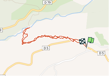

Length
2.5 km

Max alt
1123 m

Uphill gradient
142 m
Km-Effort
4.4 km

Min alt
979 m

Downhill gradient
140 m
Boucle
Yes
Creation date :
2020-12-06 12:29:45.975
Updated on :
2020-12-06 19:52:32.94
2h40
Difficulty : Medium

FREE GPS app for hiking
 SityTrail
IGN / Geographical institutes
SityTrail Plus
The world is yours!
About
Trail Snowshoes of 2.5 km to be discovered at Provence-Alpes-Côte d'Azur, Maritime Alps, Andon. This trail is proposed by Palimpseste.
Description
Descente vers le Loup dans un paysage d'hiver
Photos


Positioning
Country:
France
Region :
Provence-Alpes-Côte d'Azur
Department/Province :
Maritime Alps
Municipality :
Andon
Location:
Unknown
Start:(Dec)
Start:(UTM)
327005 ; 4849319 (32T) N.
Comments