


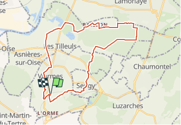
Autour de Viarmes et Royaumont

philberard95
User

Length
18.1 km

Max alt
144 m

Uphill gradient
260 m
Km-Effort
22 km

Min alt
24 m

Downhill gradient
262 m
Boucle
Yes
Creation date :
2020-12-09 10:43:40.66
Updated on :
2023-01-11 10:57:46.133
4h42
Difficulty : Very difficult

FREE GPS app for hiking
 SityTrail
IGN / Geographical institutes
SityTrail Plus
The world is yours!
About
Trail Walking of 18.1 km to be discovered at Ile-de-France, Val-d'Oise, Viarmes. This trail is proposed by philberard95.

Positioning
Country:
France
Region :
Ile-de-France
Department/Province :
Val-d'Oise
Municipality :
Viarmes
Location:
Unknown
Start:(Dec)
Start:(UTM)
454010 ; 5440750 (31U) N.
Comments