


GTO mars 2014

mouss65
User
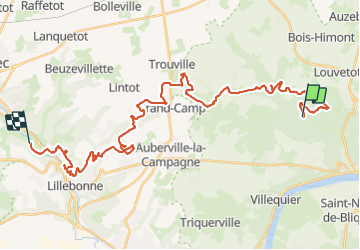

Length
38 km

Max alt
155 m

Uphill gradient
891 m
Km-Effort
50 km

Min alt
5 m

Downhill gradient
930 m
Boucle
No
Creation date :
2014-12-10 00:00:00.0
Updated on :
2014-12-10 00:00:00.0
--
Difficulty : Difficult

FREE GPS app for hiking
 SityTrail
IGN / Geographical institutes
SityTrail Plus
The world is yours!
About
Trail Running of 38 km to be discovered at Normandy, Seine-Maritime, Maulévrier-Sainte-Gertrude. This trail is proposed by mouss65.
Description
GTO avec manu, Laurent
Positioning
Country:
France
Region :
Normandy
Department/Province :
Seine-Maritime
Municipality :
Maulévrier-Sainte-Gertrude
Location:
Unknown
Start:(Dec)
Start:(UTM)
332976 ; 5491119 (31U) N.
Comments