


Maison du Canoe - Savières

DaVinci
User
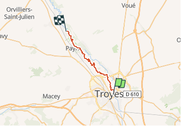

Length
23 km

Max alt
107 m

Uphill gradient
85 m
Km-Effort
24 km

Min alt
84 m

Downhill gradient
101 m
Boucle
No
Creation date :
2020-12-13 16:41:37.2
Updated on :
2020-12-13 16:58:03.414
3h50
Difficulty : Medium

FREE GPS app for hiking
 SityTrail
IGN / Geographical institutes
SityTrail Plus
The world is yours!
About
Trail Canoe - kayak of 23 km to be discovered at Grand Est, Aube, Troyes. This trail is proposed by DaVinci.
Positioning
Country:
France
Region :
Grand Est
Department/Province :
Aube
Municipality :
Troyes
Location:
Unknown
Start:(Dec)
Start:(UTM)
580434 ; 5349773 (31U) N.
Comments