


Embers et Castelmore

robertperello
User
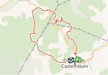

Length
11.2 km

Max alt
334 m

Uphill gradient
347 m
Km-Effort
15.9 km

Min alt
168 m

Downhill gradient
349 m
Boucle
Yes
Creation date :
2020-12-16 09:06:08.0
Updated on :
2020-12-16 14:13:42.834
3h23
Difficulty : Medium

FREE GPS app for hiking
 SityTrail
IGN / Geographical institutes
SityTrail Plus
The world is yours!
About
Trail Walking of 11.2 km to be discovered at Occitania, Aude, Embres-et-Castelmaure. This trail is proposed by robertperello.
Description
Moyen
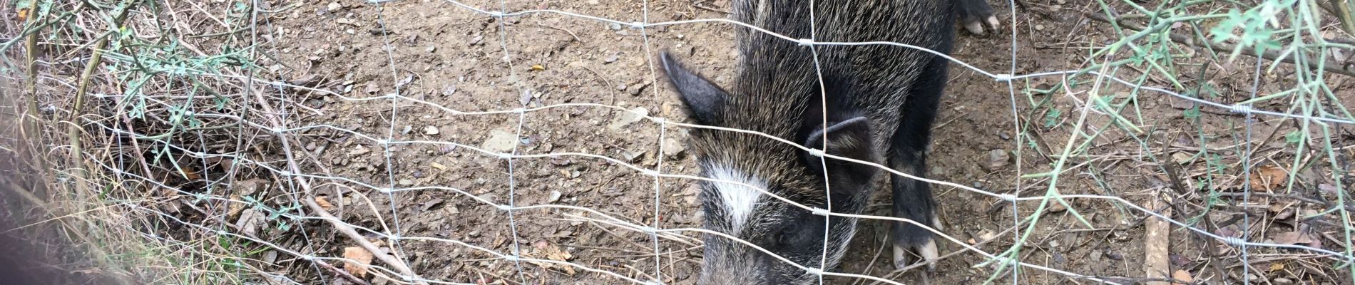
Photos

Positioning
Country:
France
Region :
Occitania
Department/Province :
Aude
Municipality :
Embres-et-Castelmaure
Location:
Unknown
Start:(Dec)
Start:(UTM)
484662 ; 4754038 (31T) N.
Comments