


CIMA

Daniel Benteux
User
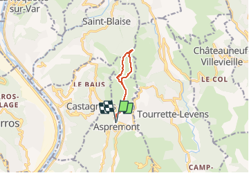

Length
7.8 km

Max alt
867 m

Uphill gradient
422 m
Km-Effort
13.4 km

Min alt
499 m

Downhill gradient
423 m
Boucle
Yes
Creation date :
2020-12-17 08:31:10.856
Updated on :
2020-12-17 13:14:10.423
2h43
Difficulty : Easy

FREE GPS app for hiking
 SityTrail
IGN / Geographical institutes
SityTrail Plus
The world is yours!
About
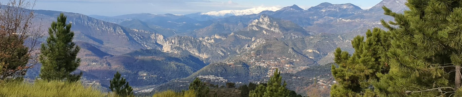
Trail Walking of 7.8 km to be discovered at Provence-Alpes-Côte d'Azur, Maritime Alps, Aspremont. This trail is proposed by Daniel Benteux.
Description
rando Cima
Photos


Positioning
Country:
France
Region :
Provence-Alpes-Côte d'Azur
Department/Province :
Maritime Alps
Municipality :
Aspremont
Location:
Unknown
Start:(Dec)
Start:(UTM)
358703 ; 4849441 (32T) N.
Comments