


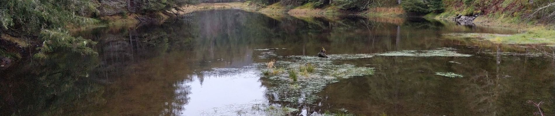
autour de l'étang de Belbriette

lepompi
User
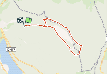

Length
7.2 km

Max alt
899 m

Uphill gradient
180 m
Km-Effort
9.7 km

Min alt
810 m

Downhill gradient
180 m
Boucle
Yes
Creation date :
2020-12-21 12:48:19.985
Updated on :
2020-12-21 12:55:00.285
2h03
Difficulty : Medium

FREE GPS app for hiking
 SityTrail
IGN / Geographical institutes
SityTrail Plus
The world is yours!
About
Trail Walking of 7.2 km to be discovered at Grand Est, Vosges, Xonrupt-Longemer. This trail is proposed by lepompi.
Description
randonnée très plaisante....superbe sous la neige
Photos


Positioning
Country:
France
Region :
Grand Est
Department/Province :
Vosges
Municipality :
Xonrupt-Longemer
Location:
Unknown
Start:(Dec)
Start:(UTM)
348117 ; 5327624 (32U) N.
Comments