


les tumulus

pierrol
User
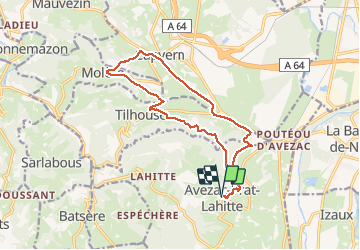

Length
15.8 km

Max alt
655 m

Uphill gradient
340 m
Km-Effort
20 km

Min alt
481 m

Downhill gradient
343 m
Boucle
Yes
Creation date :
2020-12-21 09:00:51.736
Updated on :
2020-12-21 13:26:29.902
3h58
Difficulty : Easy

FREE GPS app for hiking
 SityTrail
IGN / Geographical institutes
SityTrail Plus
The world is yours!
About
Trail Walking of 15.8 km to be discovered at Occitania, Hautespyrenees, Avezac-Prat-Lahitte. This trail is proposed by pierrol.
Positioning
Country:
France
Region :
Occitania
Department/Province :
Hautespyrenees
Municipality :
Avezac-Prat-Lahitte
Location:
Unknown
Start:(Dec)
Start:(UTM)
283198 ; 4771630 (31T) N.
Comments