


MOYEN Thon Samson

clemsdpp
User
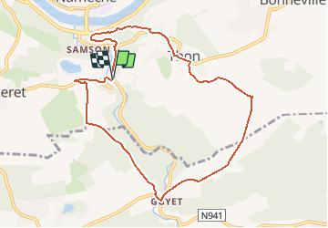

Length
8.5 km

Max alt
203 m

Uphill gradient
244 m
Km-Effort
11.8 km

Min alt
84 m

Downhill gradient
239 m
Boucle
Yes
Creation date :
2020-12-26 16:21:28.139
Updated on :
2021-02-22 22:19:19.777
--
Difficulty : Medium

FREE GPS app for hiking
 SityTrail
IGN / Geographical institutes
SityTrail Plus
The world is yours!
About
Trail On foot of 8.5 km to be discovered at Wallonia, Namur, Andenne. This trail is proposed by clemsdpp.

Positioning
Country:
Belgium
Region :
Wallonia
Department/Province :
Namur
Municipality :
Andenne
Location:
Thon
Start:(Dec)
Start:(UTM)
641960 ; 5591824 (31U) N.
Comments