


Vieux Nice- Beaulieu par la côte

coriace
User
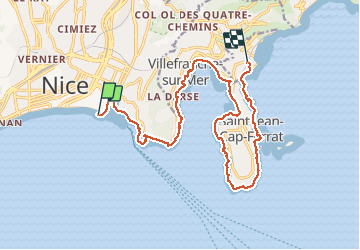

Length
18.1 km

Max alt
79 m

Uphill gradient
402 m
Km-Effort
23 km

Min alt
-1 m

Downhill gradient
394 m
Boucle
No
Creation date :
2020-12-30 11:53:58.156
Updated on :
2020-12-30 16:23:29.39
3h57
Difficulty : Easy

FREE GPS app for hiking
 SityTrail
IGN / Geographical institutes
SityTrail Plus
The world is yours!
About
Trail Walking of 18.1 km to be discovered at Provence-Alpes-Côte d'Azur, Maritime Alps, Nice. This trail is proposed by coriace.
Description
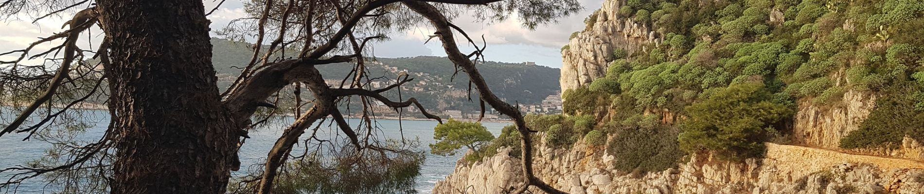
Départ Vieux Nice vers gare de Beaulieu par la côte en passant par St Jean Cap Ferrat
Photos


Positioning
Country:
France
Region :
Provence-Alpes-Côte d'Azur
Department/Province :
Maritime Alps
Municipality :
Nice
Location:
Unknown
Start:(Dec)
Start:(UTM)
361403 ; 4839249 (32T) N.
Comments
Magnique. Merci pour cette randonnée.