


superbe rando autour de thuin

Raphaël Richez
User

Length
13.2 km

Max alt
194 m

Uphill gradient
322 m
Km-Effort
17.5 km

Min alt
108 m

Downhill gradient
324 m
Boucle
Yes
Creation date :
2021-01-02 11:30:50.112
Updated on :
2021-01-02 15:39:20.621
2h56
Difficulty : Medium

FREE GPS app for hiking
 SityTrail
IGN / Geographical institutes
SityTrail Plus
The world is yours!
About
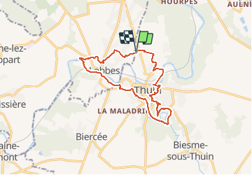
Trail Walking of 13.2 km to be discovered at Wallonia, Hainaut, Thuin. This trail is proposed by Raphaël Richez.
Description
attention pentes importante s a certains endroits mais de lieux bucoliques 👍♥️🐕
Positioning
Country:
Belgium
Region :
Wallonia
Department/Province :
Hainaut
Municipality :
Thuin
Location:
Thuin
Start:(Dec)
Start:(UTM)
591147 ; 5578473 (31U) N.
Comments