


bondues aerodrome

jeanluc59
User

Length
11.6 km

Max alt
34 m

Uphill gradient
58 m
Km-Effort
12.4 km

Min alt
12 m

Downhill gradient
58 m
Boucle
Yes
Creation date :
2021-01-02 13:02:07.269
Updated on :
2024-06-09 18:34:55.52
2h48
Difficulty : Difficult

FREE GPS app for hiking
 SityTrail
IGN / Geographical institutes
SityTrail Plus
The world is yours!
About
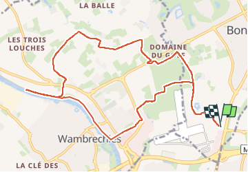
Trail Walking of 11.6 km to be discovered at Hauts-de-France, Nord, Bondues. This trail is proposed by jeanluc59.
Positioning
Country:
France
Region :
Hauts-de-France
Department/Province :
Nord
Municipality :
Bondues
Location:
Unknown
Start:(Dec)
Start:(UTM)
505989 ; 5615157 (31U) N.
Comments