


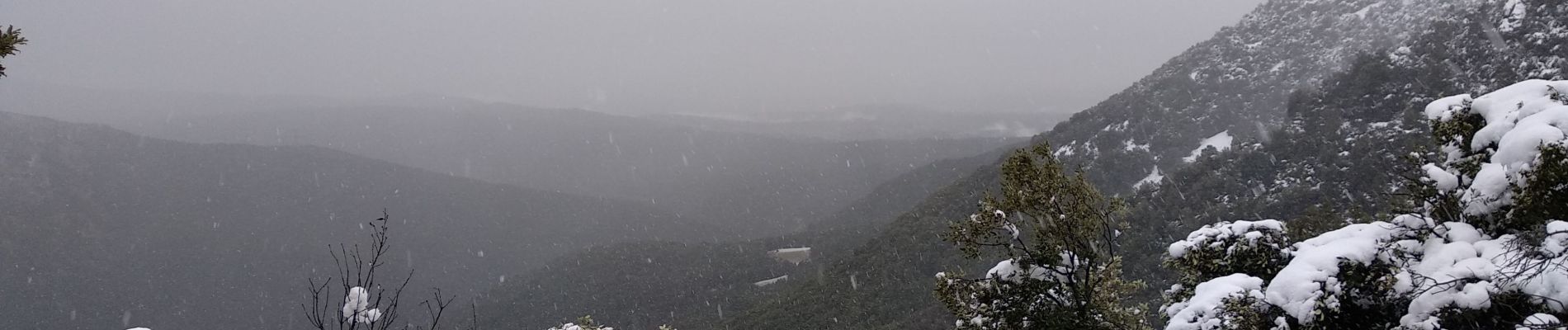
Escragnolles , Rouyère chapelle Saint Matin en hiver

Palimpseste
User
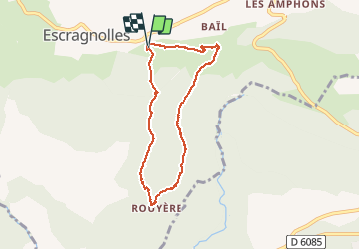

Length
7.1 km

Max alt
1090 m

Uphill gradient
310 m
Km-Effort
11.3 km

Min alt
796 m

Downhill gradient
310 m
Boucle
Yes
Creation date :
2021-01-02 13:50:54.207
Updated on :
2021-01-02 23:14:46.453
1h46
Difficulty : Medium
--
Difficulty : Medium

FREE GPS app for hiking
 SityTrail
IGN / Geographical institutes
SityTrail Plus
The world is yours!
About
Trail Walking of 7.1 km to be discovered at Provence-Alpes-Côte d'Azur, Maritime Alps, Escragnolles. This trail is proposed by Palimpseste.
Description
Randonnée mixte : commencée en raquette, continuée sans puis retour à la neige. Photos rares de la vallée de la Siagne sous la neige
Photos


Positioning
Country:
France
Region :
Provence-Alpes-Côte d'Azur
Department/Province :
Maritime Alps
Municipality :
Escragnolles
Location:
Unknown
Start:(Dec)
Start:(UTM)
322302 ; 4844123 (32T) N.
Comments