


Tour de Mauvezin

lorenzot54
User

Length
4.3 km

Max alt
180 m

Uphill gradient
66 m
Km-Effort
5.2 km

Min alt
125 m

Downhill gradient
66 m
Boucle
Yes
Creation date :
2021-01-10 14:02:40.0
Updated on :
2021-01-10 15:43:34.835
1h20
Difficulty : Unknown

FREE GPS app for hiking
 SityTrail
IGN / Geographical institutes
SityTrail Plus
The world is yours!
About
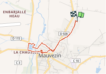
Trail Walking of 4.3 km to be discovered at Occitania, Gers, Mauvezin. This trail is proposed by lorenzot54.
Description
Passer long du temple, petit sentier long piscine arrivée au parc de jeu. Traverser l'arrats par vieux moulin puis faire le tour du lac. On remonte par le parc du château fort en terrasse.
Positioning
Country:
France
Region :
Occitania
Department/Province :
Gers
Municipality :
Mauvezin
Location:
Unknown
Start:(Dec)
Start:(UTM)
329762 ; 4844911 (31T) N.
Comments