


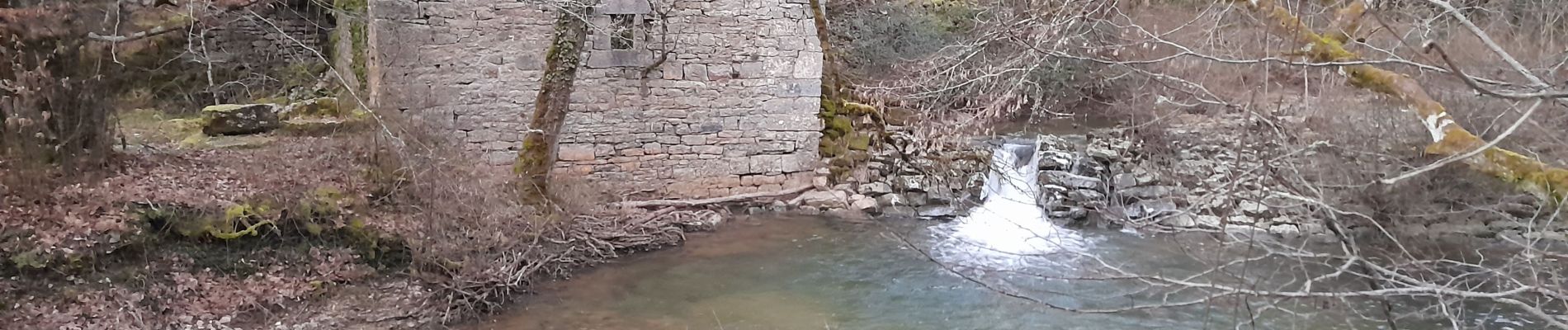
Rocamadour , magés , moulins du saut

bellouelo46
User
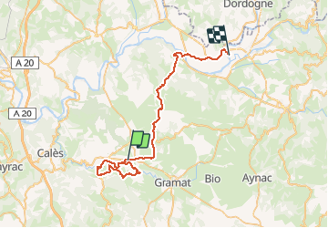

Length
46 km

Max alt
371 m

Uphill gradient
746 m
Km-Effort
56 km

Min alt
118 m

Downhill gradient
888 m
Boucle
No
Creation date :
2021-01-10 12:54:41.537
Updated on :
2021-01-10 17:37:24.972
4h41
Difficulty : Easy

FREE GPS app for hiking
 SityTrail
IGN / Geographical institutes
SityTrail Plus
The world is yours!
About
Trail Walking of 46 km to be discovered at Occitania, Lot, Rocamadour. This trail is proposed by bellouelo46.
Description
autour de rocamadour
Photos


Positioning
Country:
France
Region :
Occitania
Department/Province :
Lot
Municipality :
Rocamadour
Location:
Unknown
Start:(Dec)
Start:(UTM)
393698 ; 4961976 (31T) N.
Comments