


cormeilles

Eve - Line
User
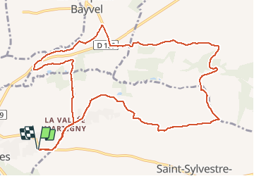

Length
13 km

Max alt
169 m

Uphill gradient
209 m
Km-Effort
15.8 km

Min alt
78 m

Downhill gradient
210 m
Boucle
Yes
Creation date :
2021-01-16 08:10:36.52
Updated on :
2021-01-16 11:05:23.021
2h53
Difficulty : Easy

FREE GPS app for hiking
 SityTrail
IGN / Geographical institutes
SityTrail Plus
The world is yours!
About
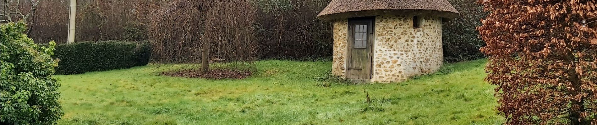
Trail Walking of 13 km to be discovered at Normandy, Eure, Cormeilles. This trail is proposed by Eve - Line.
Photos


27 photos in total. Please click on a photo to see them all in the gallery.
Positioning
Country:
France
Region :
Normandy
Department/Province :
Eure
Municipality :
Cormeilles
Location:
Unknown
Start:(Dec)
Start:(UTM)
310079 ; 5458414 (31U) N.
Comments