


Aumont en halatte 10 km

Djaie60
User
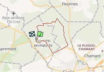

Length
10.2 km

Max alt
152 m

Uphill gradient
128 m
Km-Effort
11.9 km

Min alt
78 m

Downhill gradient
129 m
Boucle
Yes
Creation date :
2021-01-18 13:03:44.951
Updated on :
2021-01-18 13:04:47.553
--
Difficulty : Easy

FREE GPS app for hiking
 SityTrail
IGN / Geographical institutes
SityTrail Plus
The world is yours!
About
Trail On foot of 10.2 km to be discovered at Hauts-de-France, Oise, Aumont-en-Halatte. This trail is proposed by Djaie60.
Positioning
Country:
France
Region :
Hauts-de-France
Department/Province :
Oise
Municipality :
Aumont-en-Halatte
Location:
Unknown
Start:(Dec)
Start:(UTM)
466963 ; 5453271 (31U) N.
Comments