


Largentière

raab
User
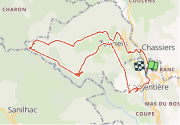

Length
12.2 km

Max alt
468 m

Uphill gradient
413 m
Km-Effort
17.7 km

Min alt
215 m

Downhill gradient
408 m
Boucle
Yes
Creation date :
2021-01-19 09:12:21.202
Updated on :
2021-01-19 14:49:06.492
5h35
Difficulty : Very easy

FREE GPS app for hiking
 SityTrail
IGN / Geographical institutes
SityTrail Plus
The world is yours!
About
Trail Walking of 12.2 km to be discovered at Auvergne-Rhône-Alpes, Ardèche, Largentière. This trail is proposed by raab.
Positioning
Country:
France
Region :
Auvergne-Rhône-Alpes
Department/Province :
Ardèche
Municipality :
Largentière
Location:
Unknown
Start:(Dec)
Start:(UTM)
602657 ; 4933151 (31T) N.
Comments