


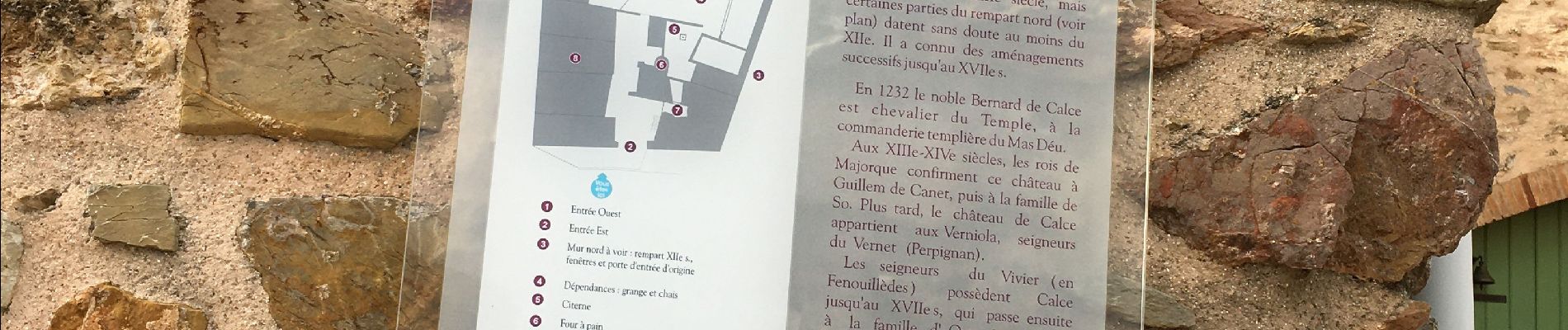
j’ai as : Ch.Sté Catherine -Calce (château)

robertperello
User

Length
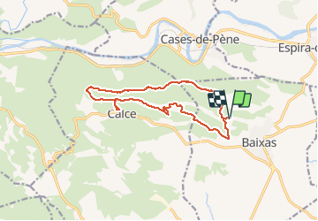
14.4 km

Max alt
323 m

Uphill gradient
338 m
Km-Effort
18.9 km

Min alt
111 m

Downhill gradient
334 m
Boucle
Yes
Creation date :
2021-01-27 08:25:36.0
Updated on :
2021-01-27 13:46:30.205
3h45
Difficulty : Very easy

FREE GPS app for hiking
 SityTrail
IGN / Geographical institutes
SityTrail Plus
The world is yours!
About
Trail Walking of 14.4 km to be discovered at Occitania, Pyrénées-Orientales, Baixas. This trail is proposed by robertperello.
Photos
 - Photo 1")
 - Photo 2")
Positioning
Country:
France
Region :
Occitania
Department/Province :
Pyrénées-Orientales
Municipality :
Baixas
Location:
Unknown
Start:(Dec)
Start:(UTM)
483435 ; 4733822 (31T) N.
Comments