


tour des plans

Daniel Benteux
User
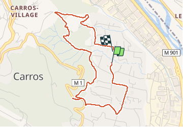

Length
5.2 km

Max alt
269 m

Uphill gradient
211 m
Km-Effort
8 km

Min alt
104 m

Downhill gradient
207 m
Boucle
Yes
Creation date :
2021-01-31 08:25:33.357
Updated on :
2021-01-31 11:13:29.502
1h43
Difficulty : Easy

FREE GPS app for hiking
 SityTrail
IGN / Geographical institutes
SityTrail Plus
The world is yours!
About
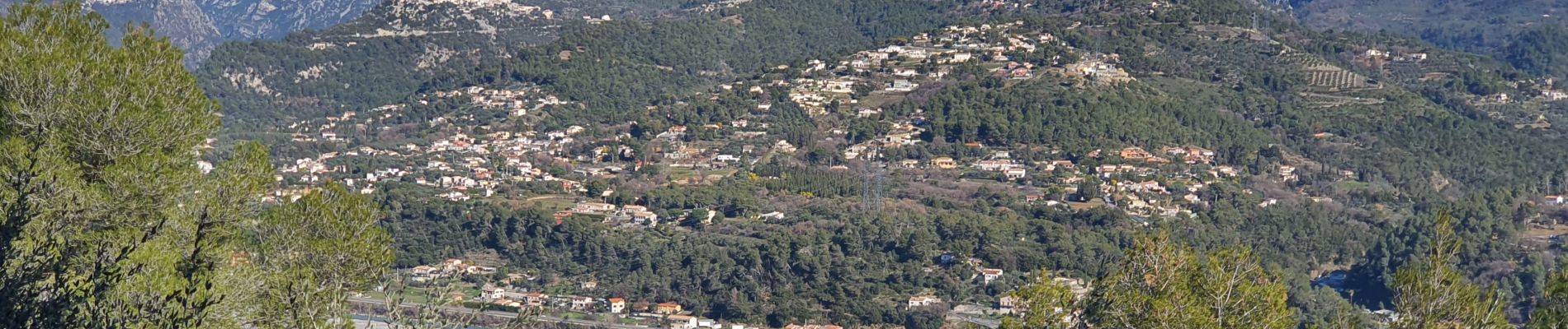
Trail Walking of 5.2 km to be discovered at Provence-Alpes-Côte d'Azur, Maritime Alps, Carros. This trail is proposed by Daniel Benteux.
Description
marche
Photos


Positioning
Country:
France
Region :
Provence-Alpes-Côte d'Azur
Department/Province :
Maritime Alps
Municipality :
Carros
Location:
Unknown
Start:(Dec)
Start:(UTM)
355333 ; 4849704 (32T) N.
Comments