


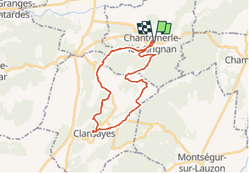
Chantemerle Clansayes 15km

thonyc
User GUIDE

Length
15.2 km

Max alt
322 m

Uphill gradient
354 m
Km-Effort
20 km

Min alt
139 m

Downhill gradient
351 m
Boucle
Yes
Creation date :
2021-01-31 08:22:40.672
Updated on :
2023-01-07 08:29:04.262
4h10
Difficulty : Medium

FREE GPS app for hiking
 SityTrail
IGN / Geographical institutes
SityTrail Plus
The world is yours!
About
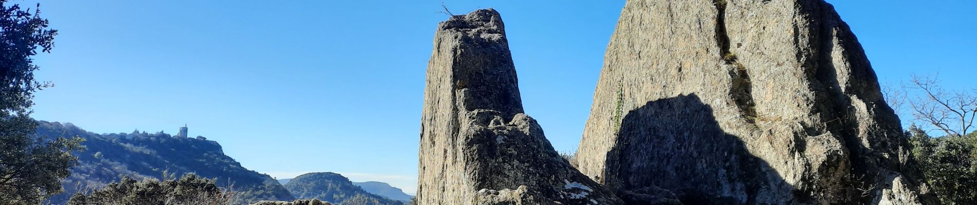
Trail Walking of 15.2 km to be discovered at Auvergne-Rhône-Alpes, Drôme, Chantemerle-lès-Grignan. This trail is proposed by thonyc.
Photos


Positioning
Country:
France
Region :
Auvergne-Rhône-Alpes
Department/Province :
Drôme
Municipality :
Chantemerle-lès-Grignan
Location:
Unknown
Start:(Dec)
Start:(UTM)
646280 ; 4918277 (31T) N.
Comments