


Saint cassien / bois de l'ermite/Ubac de peillon

Michel DUBOIS
User

Length
14.6 km

Max alt
346 m

Uphill gradient
393 m
Km-Effort
19.9 km

Min alt
147 m

Downhill gradient
394 m
Boucle
Yes
Creation date :
2021-02-01 18:18:18.658
Updated on :
2021-02-01 18:22:04.389
4h30
Difficulty : Medium

FREE GPS app for hiking
 SityTrail
IGN / Geographical institutes
SityTrail Plus
The world is yours!
About
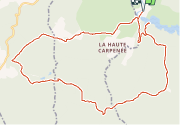
Trail Walking of 14.6 km to be discovered at Provence-Alpes-Côte d'Azur, Var, Montauroux. This trail is proposed by Michel DUBOIS.
Positioning
Country:
France
Region :
Provence-Alpes-Côte d'Azur
Department/Province :
Var
Municipality :
Montauroux
Location:
Unknown
Start:(Dec)
Start:(UTM)
320240 ; 4828566 (32T) N.
Comments