


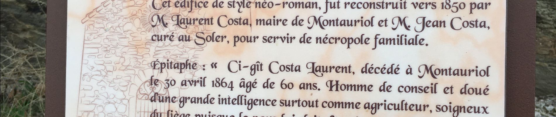
Oms(cimetière) mas Costa pic Calcine

robertperello
User

Length
11.6 km

Max alt
597 m

Uphill gradient
374 m
Km-Effort
16.6 km

Min alt
254 m

Downhill gradient
371 m
Boucle
Yes
Creation date :
2021-02-03 08:44:48.0
Updated on :
2021-02-03 14:04:47.963
2h56
Difficulty : Easy

FREE GPS app for hiking
 SityTrail
IGN / Geographical institutes
SityTrail Plus
The world is yours!
About
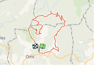
Trail Walking of 11.6 km to be discovered at Occitania, Pyrénées-Orientales, Oms. This trail is proposed by robertperello.
Description
Panorama
Photos
 mas Costa pic Calcine - Photo 1")
 mas Costa pic Calcine - Photo 2")
Positioning
Country:
France
Region :
Occitania
Department/Province :
Pyrénées-Orientales
Municipality :
Oms
Location:
Unknown
Start:(Dec)
Start:(UTM)
475615 ; 4710391 (31T) N.
Comments