


2021-02-03

Valmeinier
User

Length
9.3 km

Max alt
833 m

Uphill gradient
519 m
Km-Effort
16.3 km

Min alt
338 m

Downhill gradient
521 m
Boucle
Yes
Creation date :
2021-02-04 05:54:46.834
Updated on :
2021-02-04 05:55:15.908
3h41
Difficulty : Difficult

FREE GPS app for hiking
 SityTrail
IGN / Geographical institutes
SityTrail Plus
The world is yours!
About
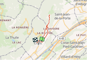
Trail Walking of 9.3 km to be discovered at Auvergne-Rhône-Alpes, Savoy, Cruet. This trail is proposed by Valmeinier.
Positioning
Country:
France
Region :
Auvergne-Rhône-Alpes
Department/Province :
Savoy
Municipality :
Cruet
Location:
Unknown
Start:(Dec)
Start:(UTM)
273002 ; 5045517 (32T) N.
Comments