Trail Walking Cramans - Cramans Mochard 2021-02-04 CAF - Photo

Cramans Mochard 2021-02-04 CAF

© OpenStreetMap contributors
Length
Length
21 km
Max alt
Max alt
417 m
Uphill gradient
Uphill gradient
515 m
Km-Effort
Km-Effort  
28 km
Min alt
Min alt
229 m
Downhill gradient
Downhill gradient
521 m
Boucle
Boucle
Yes
Creation date :
2021-02-04 07:37:16.384
Updated on :
2021-02-04 16:50:08.131

(0 Reviews)

Walking
Walking
4h27
Difficulty : Medium

Scan this QR Code to open this trail in the SityTrail application

FREE GPS app for hiking

Logo SityTrail SityTrail

IGN / Geographical institutes

Download SityTrail from the App Store Download SityTrail from Google Play

Logo SityTrail SityTrail Plus

The world is yours!

Download SityTrail from the App Store Download SityTrail from Google Play Download SityTrail on Huawei AppGallery

About

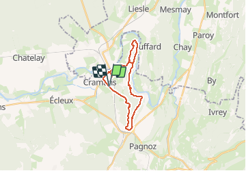
Trail Walking of 21 km to be discovered at Bourgogne-Franche-Comté, Jura, Cramans. This trail is proposed by TRIMAILLE.

Description

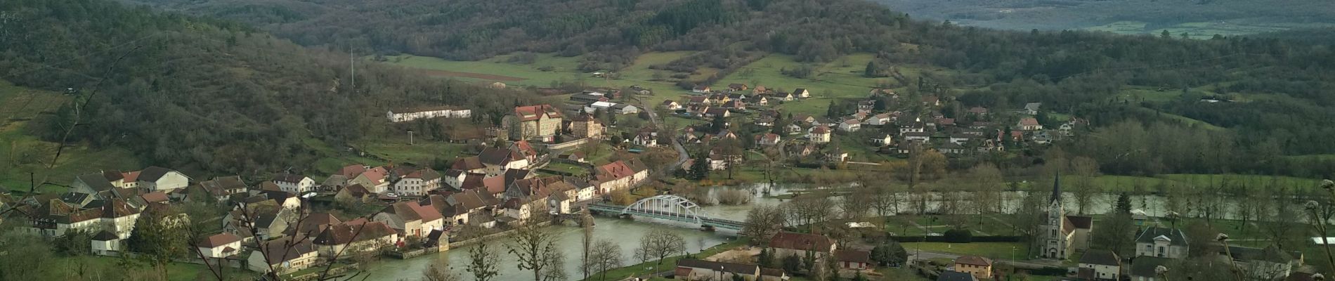
Départ de la station de pompage de Cramans au croisement de la D121 et D48.
A noter une partie hors sentier en début de la rando.
La bonne moitié de la randonnée est en forêt.
A voir Belvédères, chapelle de Lorette, conservatoire de la vigne.

Attention voir le point d’intérêt parcours.

Elevation profile

Photos

Positioning

Country:
France
Region :
Bourgogne-Franche-Comté
Department/Province :
Jura
Municipality :
Cramans
Location:
Unknown
Start:(UTM)
711776 ; 5209832 (31T) N.


Close
My subscriptions