


2021-02-04

Valmeinier
User

Length
10.5 km

Max alt
884 m

Uphill gradient
600 m
Km-Effort
18.5 km

Min alt
325 m

Downhill gradient
599 m
Boucle
Yes
Creation date :
2021-02-06 06:32:39.753
Updated on :
2021-02-06 06:34:13.261
4h12
Difficulty : Difficult

FREE GPS app for hiking
 SityTrail
IGN / Geographical institutes
SityTrail Plus
The world is yours!
About
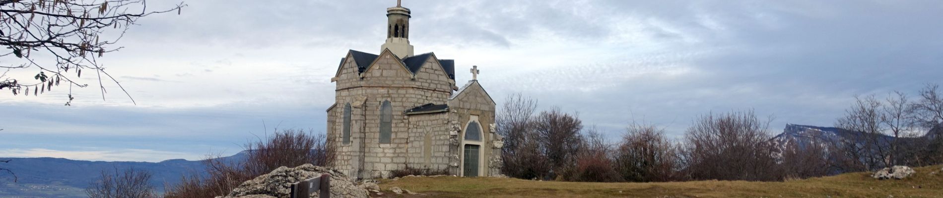
Trail Walking of 10.5 km to be discovered at Auvergne-Rhône-Alpes, Savoy, Saint-Jeoire-Prieuré. This trail is proposed by Valmeinier.
Photos

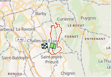
Positioning
Country:
France
Region :
Auvergne-Rhône-Alpes
Department/Province :
Savoy
Municipality :
Saint-Jeoire-Prieuré
Location:
Unknown
Start:(Dec)
Start:(UTM)
733469 ; 5047267 (31T) N.
Comments