


La rando de Pascal

nouga
User

Length
43 km

Max alt
378 m

Uphill gradient
595 m
Km-Effort
51 km

Min alt
172 m

Downhill gradient
580 m
Boucle
No
Creation date :
2021-02-07 07:29:55.387
Updated on :
2021-02-07 12:01:13.628
4h30
Difficulty : Very easy

FREE GPS app for hiking
 SityTrail
IGN / Geographical institutes
SityTrail Plus
The world is yours!
About
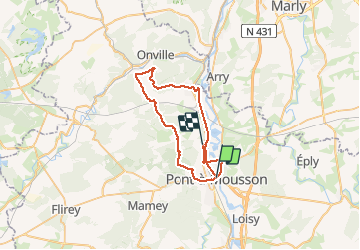
Trail Mountain bike of 43 km to be discovered at Grand Est, Meurthe-et-Moselle, Pont-à-Mousson. This trail is proposed by nouga.
Description
Très bonne sortie
Positioning
Country:
France
Region :
Grand Est
Department/Province :
Meurthe-et-Moselle
Municipality :
Pont-à-Mousson
Location:
Unknown
Start:(Dec)
Start:(UTM)
284241 ; 5420945 (32U) N.
Comments