


Villers devant mouzon

Claude Luchetta
User

Length
22 km

Max alt
337 m

Uphill gradient
469 m
Km-Effort
28 km

Min alt
149 m

Downhill gradient
461 m
Boucle
No
Creation date :
2021-02-11 13:04:12.935
Updated on :
2021-02-11 22:33:16.692
5h13
Difficulty : Very easy

FREE GPS app for hiking
 SityTrail
IGN / Geographical institutes
SityTrail Plus
The world is yours!
About
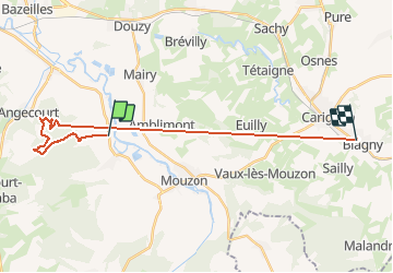
Trail Walking of 22 km to be discovered at Grand Est, Ardennes, Villers-devant-Mouzon. This trail is proposed by Claude Luchetta.
Positioning
Country:
France
Region :
Grand Est
Department/Province :
Ardennes
Municipality :
Villers-devant-Mouzon
Location:
Unknown
Start:(Dec)
Start:(UTM)
646591 ; 5498805 (31U) N.
Comments