


SMA 2

magbjo
User
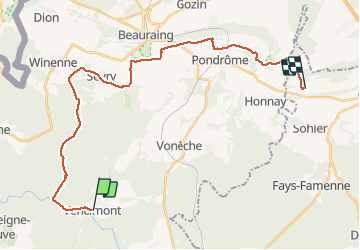

Length
26 km

Max alt
367 m

Uphill gradient
469 m
Km-Effort
32 km

Min alt
184 m

Downhill gradient
488 m
Boucle
No
Creation date :
2021-02-14 08:29:52.0
Updated on :
2021-02-14 14:48:16.563
6h16
Difficulty : Unknown

FREE GPS app for hiking
 SityTrail
IGN / Geographical institutes
SityTrail Plus
The world is yours!
About
Trail Walking of 26 km to be discovered at Wallonia, Namur, Gedinne. This trail is proposed by magbjo.
Positioning
Country:
Belgium
Region :
Wallonia
Department/Province :
Namur
Municipality :
Gedinne
Location:
Vencimont
Start:(Dec)
Start:(UTM)
637588 ; 5544014 (31U) N.
Comments