


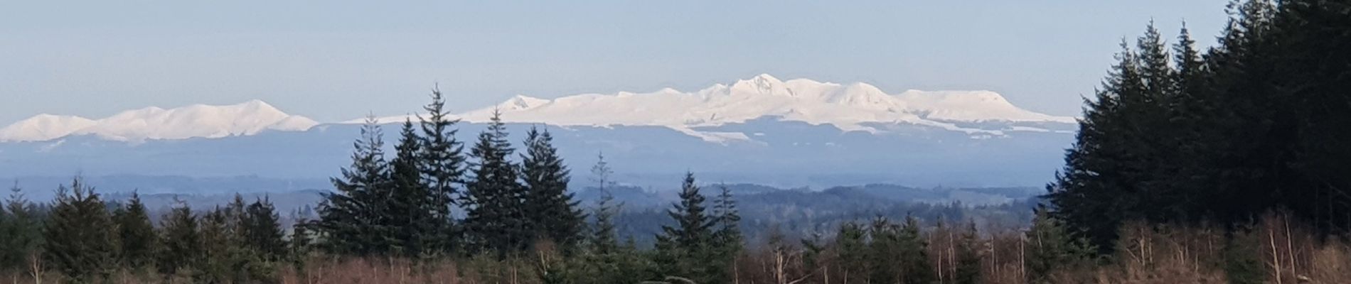
Montagne du Cloup, les Farges

viam19
User
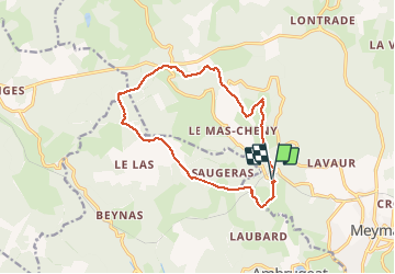

Length
13.8 km

Max alt
954 m

Uphill gradient
392 m
Km-Effort
19.1 km

Min alt
666 m

Downhill gradient
395 m
Boucle
Yes
Creation date :
2021-02-14 08:50:39.671
Updated on :
2021-02-14 15:11:04.111
4h36
Difficulty : Medium

FREE GPS app for hiking
 SityTrail
IGN / Geographical institutes
SityTrail Plus
The world is yours!
About
Trail Walking of 13.8 km to be discovered at New Aquitaine, Corrèze, Meymac. This trail is proposed by viam19.
Photos


Positioning
Country:
France
Region :
New Aquitaine
Department/Province :
Corrèze
Municipality :
Meymac
Location:
Unknown
Start:(Dec)
Start:(UTM)
430770 ; 5044227 (31T) N.
Comments