


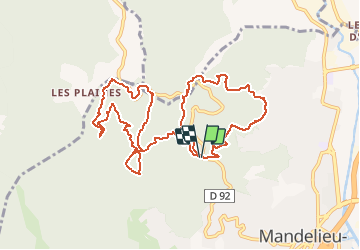
Le Grand Duc Mandelieu la Napoule (rando Gérard)

verotrail
User

Length
12.7 km

Max alt
458 m

Uphill gradient
469 m
Km-Effort
18.9 km

Min alt
207 m

Downhill gradient
468 m
Boucle
Yes
Creation date :
2021-02-15 15:14:58.945
Updated on :
2021-02-15 15:16:25.237
--
Difficulty : Easy

FREE GPS app for hiking
 SityTrail
IGN / Geographical institutes
SityTrail Plus
The world is yours!
About
Trail On foot of 12.7 km to be discovered at Provence-Alpes-Côte d'Azur, Maritime Alps, Mandelieu-la-Napoule. This trail is proposed by verotrail.
Positioning
Country:
France
Region :
Provence-Alpes-Côte d'Azur
Department/Province :
Maritime Alps
Municipality :
Mandelieu-la-Napoule
Location:
Unknown
Start:(Dec)
Start:(UTM)
331873 ; 4824551 (32T) N.
Comments