


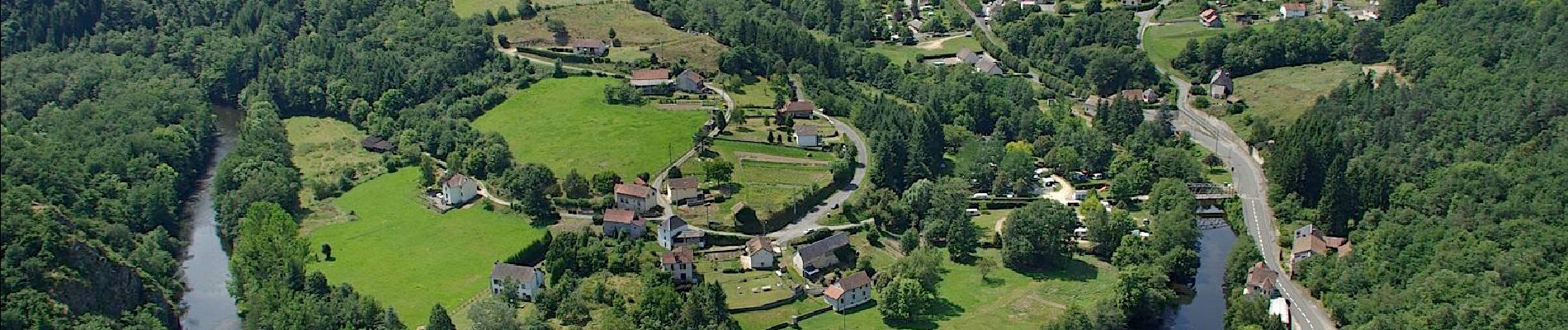
Le Got. Châteauneuf les bains

Gegetop
User
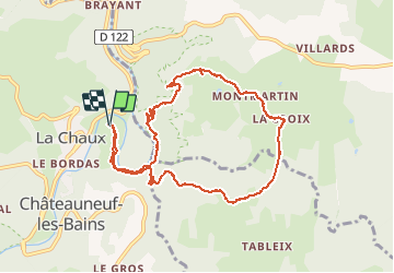

Length
9.9 km

Max alt
639 m

Uphill gradient
337 m
Km-Effort
14.4 km

Min alt
385 m

Downhill gradient
337 m
Boucle
Yes
Creation date :
2021-02-16 10:28:12.916
Updated on :
2021-02-16 16:51:39.317
2h34
Difficulty : Medium
2h30
Difficulty : Medium

FREE GPS app for hiking
 SityTrail
IGN / Geographical institutes
SityTrail Plus
The world is yours!
About
Trail Walking of 9.9 km to be discovered at Auvergne-Rhône-Alpes, Puy-de-Dôme, Châteauneuf-les-Bains. This trail is proposed by Gegetop.
Description
Jolie balade avec un dénivelé assez raide mais très ombragé.
Photos


Positioning
Country:
France
Region :
Auvergne-Rhône-Alpes
Department/Province :
Puy-de-Dôme
Municipality :
Châteauneuf-les-Bains
Location:
Unknown
Start:(Dec)
Start:(UTM)
492487 ; 5097266 (31T) N.
Comments