


strava_full(3)

Kaiser113
User
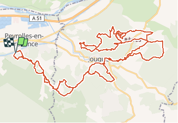

Length
48 km

Max alt
420 m

Uphill gradient
924 m
Km-Effort
60 km

Min alt
225 m

Downhill gradient
923 m
Boucle
Yes
Creation date :
2021-02-16 20:22:48.737
Updated on :
2021-02-16 20:22:48.737
--
Difficulty : Unknown

FREE GPS app for hiking
 SityTrail
IGN / Geographical institutes
SityTrail Plus
The world is yours!
About
Trail Mountain bike of 48 km to be discovered at Provence-Alpes-Côte d'Azur, Bouches-du-Rhône, Peyrolles-en-Provence. This trail is proposed by Kaiser113.
Positioning
Country:
France
Region :
Provence-Alpes-Côte d'Azur
Department/Province :
Bouches-du-Rhône
Municipality :
Peyrolles-en-Provence
Location:
Unknown
Start:(Dec)
Start:(UTM)
707966 ; 4835097 (31T) N.
Comments