


VESC3

thonyc
User GUIDE
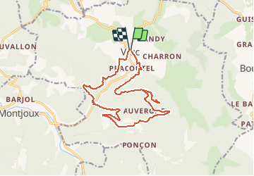

Length
17.5 km

Max alt
1074 m

Uphill gradient
721 m
Km-Effort
27 km

Min alt
512 m

Downhill gradient
717 m
Boucle
Yes
Creation date :
2021-02-17 08:09:11.667
Updated on :
2021-02-21 18:17:40.672
5h00
Difficulty : Difficult

FREE GPS app for hiking
 SityTrail
IGN / Geographical institutes
SityTrail Plus
The world is yours!
About
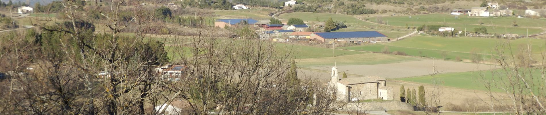
Trail Walking of 17.5 km to be discovered at Auvergne-Rhône-Alpes, Drôme, Vesc. This trail is proposed by thonyc.
Photos


Positioning
Country:
France
Region :
Auvergne-Rhône-Alpes
Department/Province :
Drôme
Municipality :
Vesc
Location:
Unknown
Start:(Dec)
Start:(UTM)
671017 ; 4932093 (31T) N.
Comments