


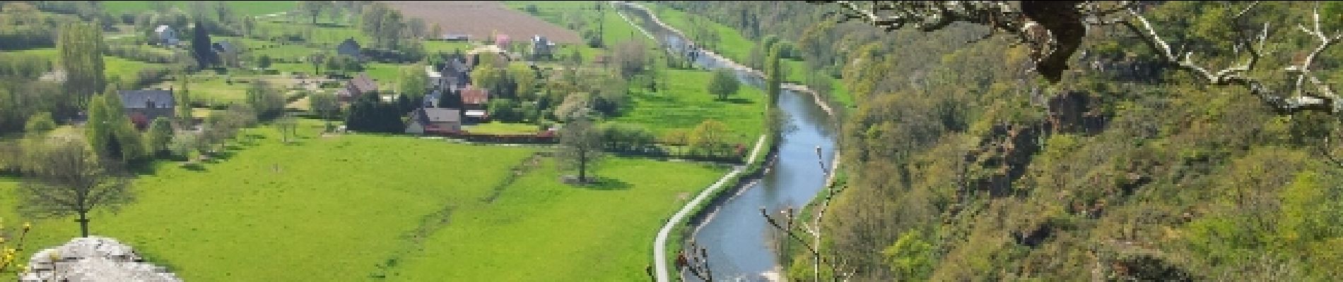
Roches de ham

phi14
User
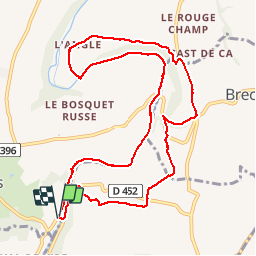

Length
11.1 km

Max alt
111 m

Uphill gradient
179 m
Km-Effort
13.5 km

Min alt
25 m

Downhill gradient
177 m
Boucle
Yes
Creation date :
2014-12-10 00:00:00.0
Updated on :
2014-12-10 00:00:00.0
2h58
Difficulty : Easy

FREE GPS app for hiking
 SityTrail
IGN / Geographical institutes
SityTrail Plus
The world is yours!
About
Trail Walking of 11.1 km to be discovered at Normandy, Manche, Condé-sur-Vire. This trail is proposed by phi14.
Description
Aire de pique-nique très agréable à la Chapelle sur Vire.
Photos


Positioning
Country:
France
Region :
Normandy
Department/Province :
Manche
Municipality :
Condé-sur-Vire
Location:
Troisgots
Start:(Dec)
Start:(UTM)
641987 ; 5430109 (30U) N.
Comments
sympa. à découvrir avec une pause crêpes a mi parcours