


GTMC J1

PhilippeC54
User

Length
53 km

Max alt
1109 m

Uphill gradient
1563 m
Km-Effort
73 km

Min alt
479 m

Downhill gradient
1177 m
Boucle
No
Creation date :
2017-06-17 00:00:00.0
Updated on :
2017-06-17 00:00:00.0
4h42
Difficulty : Easy

FREE GPS app for hiking
 SityTrail
IGN / Geographical institutes
SityTrail Plus
The world is yours!
About
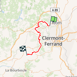
Trail Mountain bike of 53 km to be discovered at Auvergne-Rhône-Alpes, Puy-de-Dôme, Volvic. This trail is proposed by PhilippeC54.
Description
2 : Volvic - Le Vauriat
3 : Le Vauriat - Laschamps
4 : Laschamps - Orcival
Positioning
Country:
France
Region :
Auvergne-Rhône-Alpes
Department/Province :
Puy-de-Dôme
Municipality :
Volvic
Location:
Unknown
Start:(Dec)
Start:(UTM)
503637 ; 5079879 (31T) N.
Comments