


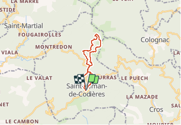
Saint Roman de Codiere

Dupuybadonniere
User

Length
10.4 km

Max alt
877 m

Uphill gradient
386 m
Km-Effort
15.6 km

Min alt
538 m

Downhill gradient
389 m
Boucle
Yes
Creation date :
2021-02-21 09:08:58.597
Updated on :
2021-02-21 15:23:58.568
3h09
Difficulty : Very easy

FREE GPS app for hiking
 SityTrail
IGN / Geographical institutes
SityTrail Plus
The world is yours!
About
Trail Walking of 10.4 km to be discovered at Occitania, Gard, Saint-Roman-de-Codières. This trail is proposed by Dupuybadonniere.
Positioning
Country:
France
Region :
Occitania
Department/Province :
Gard
Municipality :
Saint-Roman-de-Codières
Location:
Unknown
Start:(Dec)
Start:(UTM)
562401 ; 4872472 (31T) N.
Comments