


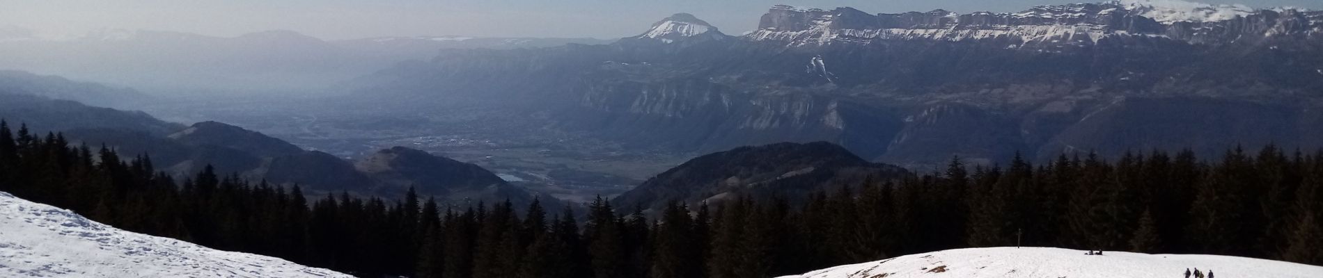
Le Crêt du Poulet

crocau
User
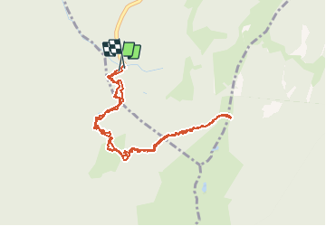

Length
4.9 km

Max alt
1726 m

Uphill gradient
296 m
Km-Effort
8.8 km

Min alt
1426 m

Downhill gradient
288 m
Boucle
Yes
Creation date :
2021-02-21 12:03:40.328
Updated on :
2021-02-21 22:06:08.756
2h37
Difficulty : Very easy

FREE GPS app for hiking
 SityTrail
IGN / Geographical institutes
SityTrail Plus
The world is yours!
About
Trail Walking of 4.9 km to be discovered at Auvergne-Rhône-Alpes, Isère, Crêts-en-Belledonne. This trail is proposed by crocau.
Photos

Positioning
Country:
France
Region :
Auvergne-Rhône-Alpes
Department/Province :
Isère
Municipality :
Crêts-en-Belledonne
Location:
Saint-Pierre-d'Allevard
Start:(Dec)
Start:(UTM)
268571 ; 5023265 (32T) N.
Comments