


2021-02-21

Valmeinier
User
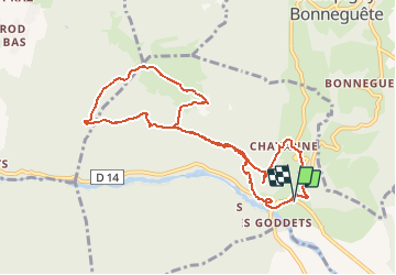

Length
10 km

Max alt
931 m

Uphill gradient
668 m
Km-Effort
18.9 km

Min alt
310 m

Downhill gradient
670 m
Boucle
Yes
Creation date :
2021-02-22 09:01:53.119
Updated on :
2021-02-22 09:03:43.009
4h17
Difficulty : Difficult

FREE GPS app for hiking
 SityTrail
IGN / Geographical institutes
SityTrail Plus
The world is yours!
About
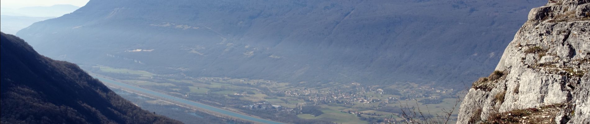
Trail Walking of 10 km to be discovered at Auvergne-Rhône-Alpes, Upper Savoy, Vallières-sur-Fier. This trail is proposed by Valmeinier.
Photos


Positioning
Country:
France
Region :
Auvergne-Rhône-Alpes
Department/Province :
Upper Savoy
Municipality :
Vallières-sur-Fier
Location:
Val-de-Fier
Start:(Dec)
Start:(UTM)
724570 ; 5090403 (31T) N.
Comments