


Paris sur Seine

c.chehere
User
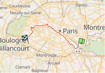

Length
16.2 km

Max alt
85 m

Uphill gradient
268 m
Km-Effort
19.7 km

Min alt
20 m

Downhill gradient
268 m
Boucle
No
Creation date :
2021-02-22 07:26:09.65
Updated on :
2021-02-22 13:58:32.585
4h47
Difficulty : Easy

FREE GPS app for hiking
 SityTrail
IGN / Geographical institutes
SityTrail Plus
The world is yours!
About
Trail Walking of 16.2 km to be discovered at Ile-de-France, Paris, Paris. This trail is proposed by c.chehere.
Description
Balade urbaine en suivant la Seine. Depuis la station "baron Leroy" du T3a jusqu'à la place Balard. Possibilité de reprendre le T3a.
Itinéraire balisé GR 2 & 22.
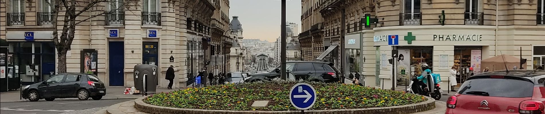
Photos


Positioning
Country:
France
Region :
Ile-de-France
Department/Province :
Paris
Municipality :
Paris
Location:
12th Arrondissement
Start:(Dec)
Start:(UTM)
455485 ; 5408775 (31U) N.
Comments