Rando en boucle Sy et My

MathieuBourgois
User
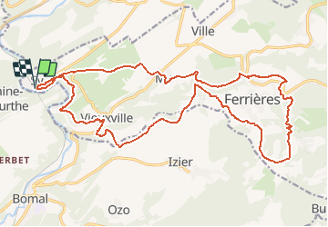

Length
23 km

Max alt
331 m

Uphill gradient
598 m
Km-Effort
31 km

Min alt
125 m

Downhill gradient
597 m
Boucle
Yes
Creation date :
2021-02-23 08:45:49.487
Updated on :
2021-02-23 08:48:22.48
--
Difficulty : Medium

FREE GPS app for hiking
 SityTrail
IGN / Geographical institutes
SityTrail Plus
The world is yours!
About
Trail On foot of 23 km to be discovered at Wallonia, Liège, Ferrières. This trail is proposed by MathieuBourgois.
Description
Rando en Fagne-Famenne à la découverte d'un des plus beaux villages de Wallonie: My
Positioning
Country:
Belgium
Region :
Wallonia
Department/Province :
Liège
Municipality :
Ferrières
Location:
Vieuxville
Start:(Dec)
Start:(UTM)
679395 ; 5586442 (31U) N.
Comments