


23 février 2021

arnoultjf
User
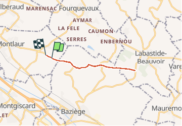

Length
10.4 km

Max alt
249 m

Uphill gradient
104 m
Km-Effort
11.8 km

Min alt
177 m

Downhill gradient
110 m
Boucle
No
Creation date :
2021-02-23 12:58:39.789
Updated on :
2021-02-23 16:09:04.167
2h05
Difficulty : Very easy

FREE GPS app for hiking
 SityTrail
IGN / Geographical institutes
SityTrail Plus
The world is yours!
About
Trail Walking of 10.4 km to be discovered at Occitania, Haute-Garonne, Montlaur. This trail is proposed by arnoultjf.
Photos


Positioning
Country:
France
Region :
Occitania
Department/Province :
Haute-Garonne
Municipality :
Montlaur
Location:
Unknown
Start:(Dec)
Start:(UTM)
386679 ; 4815250 (31T) N.
Comments