


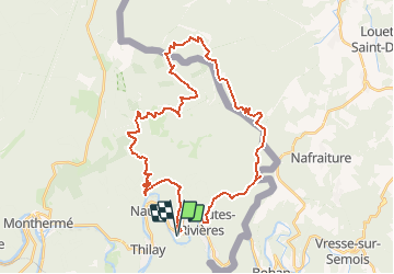
Prépa GTLC (35Km/1200D+)

choumac08
User

Length
36 km

Max alt
513 m

Uphill gradient
1205 m
Km-Effort
52 km

Min alt
160 m

Downhill gradient
1206 m
Boucle
Yes
Creation date :
2021-02-23 20:14:28.155
Updated on :
2021-03-02 18:23:59.252
--
Difficulty : Difficult

FREE GPS app for hiking
 SityTrail
IGN / Geographical institutes
SityTrail Plus
The world is yours!
About
Trail Trail of 36 km to be discovered at Grand Est, Ardennes, Thilay. This trail is proposed by choumac08.
Positioning
Country:
France
Region :
Grand Est
Department/Province :
Ardennes
Municipality :
Thilay
Location:
Unknown
Start:(Dec)
Start:(UTM)
631236 ; 5526800 (31U) N.
Comments