


Chapelle St Maurice 10km

thonyc
User GUIDE
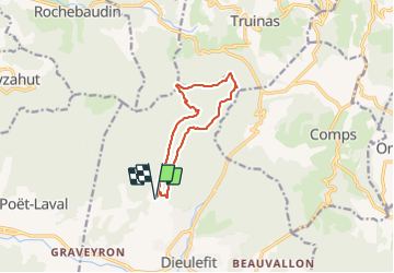

Length
10.4 km

Max alt
933 m

Uphill gradient
539 m
Km-Effort
17.6 km

Min alt
452 m

Downhill gradient
538 m
Boucle
Yes
Creation date :
2021-02-25 11:22:48.05
Updated on :
2022-02-12 16:27:51.215
4h10
Difficulty : Difficult

FREE GPS app for hiking
 SityTrail
IGN / Geographical institutes
SityTrail Plus
The world is yours!
About
Trail Walking of 10.4 km to be discovered at Auvergne-Rhône-Alpes, Drôme, Dieulefit. This trail is proposed by thonyc.
Description
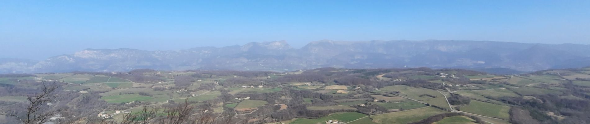
Descente après les antennes délicate
Panoramas superbes
Photos

Positioning
Country:
France
Region :
Auvergne-Rhône-Alpes
Department/Province :
Drôme
Municipality :
Dieulefit
Location:
Unknown
Start:(Dec)
Start:(UTM)
663360 ; 4933666 (31T) N.
Comments