


Refuge du Pavé

Arthur Robin
User

Length
26 km

Max alt
2937 m

Uphill gradient
1407 m
Km-Effort
45 km

Min alt
1654 m

Downhill gradient
1382 m
Boucle
No
Creation date :
2021-02-26 08:11:30.949
Updated on :
2021-02-26 17:12:42.96
6h32
Difficulty : Difficult

FREE GPS app for hiking
 SityTrail
IGN / Geographical institutes
SityTrail Plus
The world is yours!
About
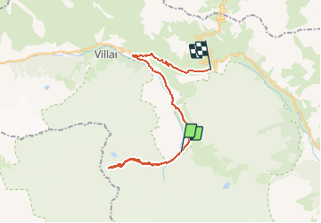
Trail Touring skiing of 26 km to be discovered at Provence-Alpes-Côte d'Azur, Hautes-Alpes, Villar-d'Arêne. This trail is proposed by Arthur Robin.
Positioning
Country:
France
Region :
Provence-Alpes-Côte d'Azur
Department/Province :
Hautes-Alpes
Municipality :
Villar-d'Arêne
Location:
Unknown
Start:(Dec)
Start:(UTM)
293307 ; 4985077 (32T) N.
Comments