


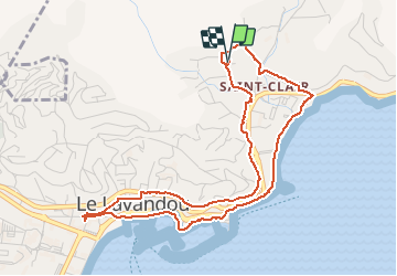
le lavandou chemin des douaniers 2021 03 01

Patrick Lemaire
User

Length
5.4 km

Max alt
34 m

Uphill gradient
72 m
Km-Effort
6.4 km

Min alt
0 m

Downhill gradient
72 m
Boucle
Yes
Creation date :
2021-03-01 09:24:11.896
Updated on :
2021-03-01 11:34:38.502
1h32
Difficulty : Very easy

FREE GPS app for hiking
 SityTrail
IGN / Geographical institutes
SityTrail Plus
The world is yours!
About
Trail Walking of 5.4 km to be discovered at Provence-Alpes-Côte d'Azur, Var, Le Lavandou. This trail is proposed by Patrick Lemaire.
Positioning
Country:
France
Region :
Provence-Alpes-Côte d'Azur
Department/Province :
Var
Municipality :
Le Lavandou
Location:
Unknown
Start:(Dec)
Start:(UTM)
286758 ; 4780426 (32T) N.
Comments