


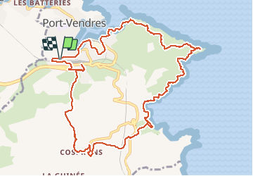
Port cendres de la mer à la montagne

robertperello
User

Length
14 km

Max alt
138 m

Uphill gradient
362 m
Km-Effort
18.9 km

Min alt
0 m

Downhill gradient
365 m
Boucle
Yes
Creation date :
2021-03-03 08:27:44.0
Updated on :
2021-03-03 14:46:15.409
4h13
Difficulty : Medium

FREE GPS app for hiking
 SityTrail
IGN / Geographical institutes
SityTrail Plus
The world is yours!
About
Trail Walking of 14 km to be discovered at Occitania, Pyrénées-Orientales, Port-Vendres. This trail is proposed by robertperello.
Description
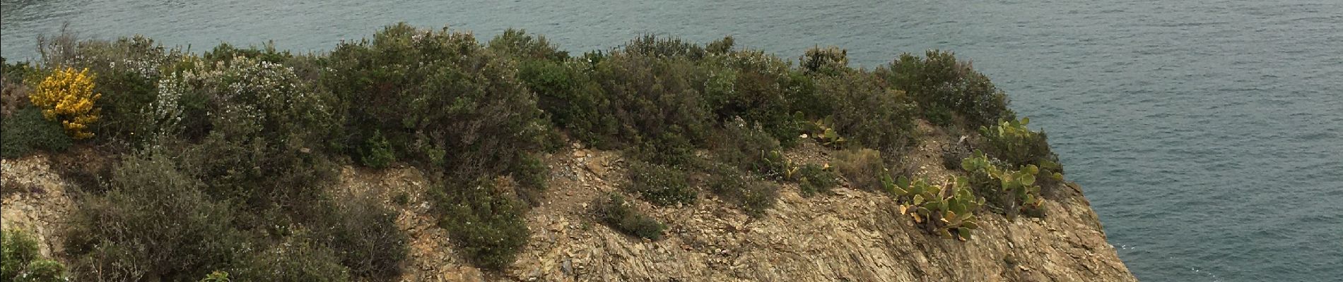
Sentier littoral - cap Bear -Paulilles -Cosprons - vol Periguer
Photos

Positioning
Country:
France
Region :
Occitania
Department/Province :
Pyrénées-Orientales
Municipality :
Port-Vendres
Location:
Unknown
Start:(Dec)
Start:(UTM)
508422 ; 4706830 (31T) N.
Comments