


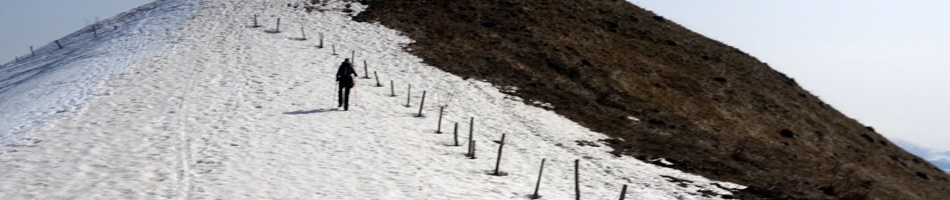
Mont-MORBIE-Routhennes-2021-03-04

Valmeinier
User
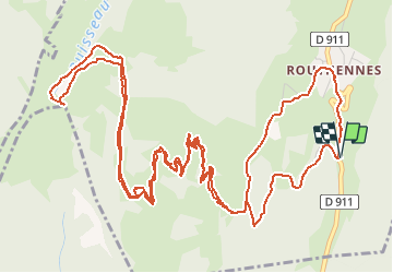

Length
10.4 km

Max alt
1527 m

Uphill gradient
676 m
Km-Effort
19.5 km

Min alt
853 m

Downhill gradient
680 m
Boucle
Yes
Creation date :
2021-03-05 04:04:40.557
Updated on :
2021-03-06 06:05:37.039
4h25
Difficulty : Easy

FREE GPS app for hiking
 SityTrail
IGN / Geographical institutes
SityTrail Plus
The world is yours!
About
Trail Walking of 10.4 km to be discovered at Auvergne-Rhône-Alpes, Savoy, Sainte-Reine. This trail is proposed by Valmeinier.
Photos


Positioning
Country:
France
Region :
Auvergne-Rhône-Alpes
Department/Province :
Savoy
Municipality :
Sainte-Reine
Location:
Unknown
Start:(Dec)
Start:(UTM)
276752 ; 5052583 (32T) N.
Comments