


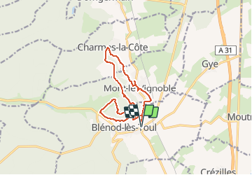
Blenod lesToul- Charme la cote

mannequ1
User

Length
12.4 km

Max alt
402 m

Uphill gradient
241 m
Km-Effort
15.6 km

Min alt
255 m

Downhill gradient
241 m
Boucle
Yes
Creation date :
2014-12-10 00:00:00.0
Updated on :
2014-12-10 00:00:00.0
3h25
Difficulty : Medium

FREE GPS app for hiking
 SityTrail
IGN / Geographical institutes
SityTrail Plus
The world is yours!
About
Trail Walking of 12.4 km to be discovered at Grand Est, Meurthe-et-Moselle, Blénod-lès-Toul. This trail is proposed by mannequ1.
Positioning
Country:
France
Region :
Grand Est
Department/Province :
Meurthe-et-Moselle
Municipality :
Blénod-lès-Toul
Location:
Unknown
Start:(Dec)
Start:(UTM)
709603 ; 5386916 (31U) N.
Comments