


Projet_Amicale_Courzieu_Brevenne

d.rognon
User


5h42
Difficulty : Very difficult

FREE GPS app for hiking
 SityTrail
IGN / Geographical institutes
SityTrail Plus
The world is yours!
About
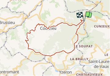
Trail Walking of 16.6 km to be discovered at Auvergne-Rhône-Alpes, Rhône, Vaugneray. This trail is proposed by d.rognon.
Description
Point de départ : Col de Malval (Latitude:45,74791 Longitude:4,61168)
Pique nique au point GPS : Latitude:45,72572 Longitude:4,55323 Altitude:701 m, 9 kms après départ, table de pique nique (Cf. photo)
Passage au pied de l'oppidum du Chatelard

Positioning
Comments